Last update April 2019. One veeery long day.
Trolltunga
Stepping on the tounge of a troll
Taking advantage of a sunny day in late summer to get to the famous Trolltunga - with a couple of hundreds fellow hikers.
Getting there - not a walk in a park
As you might have already heard elsewhere, this 22 km hike is not a walk in the park, not quickly done on a sunny afternoon, in flip-flops and shorts. Though people try exactly that, believe it or not.
With a total length of about 22 km and a duration of 8-12 hours - depending on your fitness and for how long you like to stay at the Trolltunga - it is a proper, grown-up hike up in the mountains. The destination is surely worth the effort but also the hike itself offers great views and is a reward in itself.
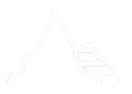
Our hike on a busy day
We knew that the hike is rather popular since about 2005 when big travel magazines started publishing pictures of the Trolltunga. Plus we decided to do it on a sunny Saturday mid September, which could have been easily the last weeked in that year to get there at all on dry ground.
We were not exactly the only ones with that idea.
We left our hotel at an insane 5:30 am to be at the parking place at Skjeggedal an hour later. Around 50 cars were parked there already and several groups gathered in the dawn, preparing for the tour. After finding a parking spot and paying the ticket, we were ready as well.
Luckily, during the day the hike did not feel crowded at all: Sure, you overtook quite many people and vice versa, but in the end it was not like walking in a line all the time.
The first bit is the hardest part
The first 1,5 km, or 404 m difference in altitude, is really a tough start. If you are somewhat trained you will be sweaty but fine - but remember you need to go down that bit at the very end of the hike again!
For that reason we used hiking sticks, a piece of equipment we usually... aeh, how to put it, rather associate with elderly people. Admittedly, we were very happy to have them at the end of that very long day.
With the first 1,5 km behind us, we started enjoying the hike as we could now pay attention to the wide, rocky landscape. The path goes a bit up and down, passes little lakes and cabins, crosses small water brooks and crawls alongside the mountainside for much of the rest of the way. From kilometer 4 onwards the view widens and you see even more of the mountains surrounding you - and from kilometer 7 you can even spot the Trolltunge itself in the distance!
Little hint: It is further to the "right" than you think and probably you can spot it only when people in colorful hiking clothes standing in line to get onto it.
Something not to look forward to...
After some breaks and not too hasty speed, we came around a last corner after about 4 hours and there it was, the Trolltunga in all its uniqueness! Sticking its rocky tongue out to the lake below since thousands of years.
Mågeliban - Not longer in operation
Until 2014 you could comfortably cover the first 440 meter difference in altitude with the Mågeliban, a cable car. Unfortunately, this was discontinued. Fortunately, they build a road instead, so you can cheat and drive up the first 400m altitude meters - but there are only 30 parking spaces and you need to reserve one upfront (600 NOK)

Tragic incident
Early September 2015 an Australian student tragically died at the Trolltunga, when she - according to newspaper reports - left the actual rock, tried to pass people standing in line waiting for their turn on the narrow side, slipped and fell a couple of hundred meters...
A sad reminder that hiking up in the mountains does come with risks.
Warning signs - not a joke
Conveniently, along the trail there are signs, informing you about how much of the distance you have covered and how much is still ahead of you.
Two of those, the one at km 1,5 and another one at km 4, additionally inform about the time by which you should have passed the signs in order to make it back safely in daylight.
Better stick to these recommendations - that is unless you have a tent with you, good flashlights or always wanted to stay high up in the mountains, in the dark and cold, probably without food, begging other people to share their small tent and even smaller sleeping bag with you :-)
The Trolltunga itself
The rock itself is rather big, so unless you are really scared of heights, you will not have a problem stepping onto it. It is an entirely different thing though whether or not you dare to let your legs dangle over the edge. As we are two chickens, we just stood there, in respectful distance from the edge, and enjoyed the beautiful view & strange feel.
And yes, there are usually quite a lot of people. But at least when we were there, they were well behaved, waiting patiently a few minutes next to the rock until all pictures were taking in all kinds of silly positions of fellow hikers in front of them.
Some people stay in tents close to the attraction and that is for sure something nice as you will be able to enjoy a bit solitude in the early morning or late night, having the scenery more or less for yourself.
Apparently, some people have even tried to put up their tent on the Trolltunge itself, but probably that attempt was quickly over with next strong wind.
Best photo spot
Apparently the best (or second best) photo spot is from slightly below the Trolltunga: Around 50 m north of the rock, you can descend a few meter, giving you a nice perspective from slightly below.
We missed that one. Damn... Looks like we need to go back again.
Alternative way up
If you are not really excited by the ordinary tour to the Trolltunga, there is an alternative route: It would be a combined bicycle (along the lake), hiking (from the lake to the Via Ferrata) and climbing tour (up the Via Ferrata).
As this requires full climbing equipment and some knowledge about the environment, that tour is not recommended to be done by yourself but rather to join a group of like minded people. Or book a tour with professionals.
The painful way back
Well, it's actually not that bad - when you use sticks or are one of these typical Norwegian-mid-50ies-incredibly-good-in-shape persons.
Which we are not, hence the sticks.
One episode to the end: On hour way back, at 4pm, we met a couple from the Middle East. They obviously had started too late and already used 3 hours for the first 2 kilometres, they had not any proper equipment with them and wore only light jogging shoes. He was eager to get to the Trolltunga, she was exhausted already, wanted to go back and constantly shouted at him.
Sadly, we were not able to convince him/them to give up and return. Unbelievable. I'm afraid they were one of those with a very unpleasant night ahead of them, either trying to find the way back to their car in the dark or finding a shelter. Or one of those who triggered one of the over 40 rescue missions that were recorded at the Trolltunga in 2015. A new sad record.
Just to share how the tour feels when you start it unprepared and uninformed, here report of a such a guy. And here a report of a group that got lost in the dark and had to be found and rescued by a helicopter.

INFO
Distance from Oslo
-
370 km / 6 hrs by car
Highlights
-
Stepping on the trolltunga, some 700m above ground
-
The walk up there and along the mountain edge
-
If it's windy you will see 2 waterfalls where the water is blown up in the air; so it's a reverse waterfall - we have never seen that before
-
Observing less prepared tourists how they manage with sneakers in the mountains...
Overnight stay we can recommend
-
Utne hotel (but it's nearly 50 km away)
Our personal extra tip
-
Start with the first sunlight to have enough time and avoid walking in a crowd
-
Be prepared for all kinds of weather, also in the summer
Dont's:
-
Dont start too late - it is a full day hike and it's strenuous
-
Don't trust the opening times of the tourist info in Odda on the net, it's not always up-to-date
More information
MAPS

Click on the map for opening the right clipping in google maps in a new window